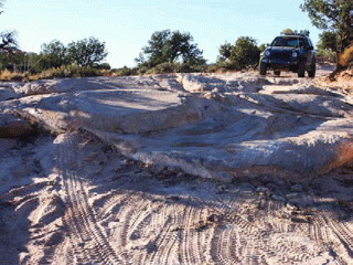
In the morning I can’t help but sit and stare at the view that surrounds my tent. It’s easy to see where one came up with the name “Panorama Point” as you sit atop 600 foot cliffs and take in the 270-degree view of the remote corners of Canyonlands. Eggs are cooked, coffee is made, gear is packed, and we’re back on the trail. The destination for today is the area known as the Dollhouse, some 40 miles away. As I descend the trail from Panorama Point, the view is dominated by the rock formation to the northwest known as Cleopatra’s Chair (a popular stop among rock climbers). A welcome break comes when you get back on the main trail. As it heads south, parallel to an area called the Orange Cliffs, the trail is smooth and fast for miles.
A second large rock formation called Bagpipe Butte makes a very jagged appearance to the east and the group relaxes in the shade at
a nice overlook. We continue southeast on smooth, hissing two-track en route to the Flint Trail, the only means of connecting the Hans Flat Ranger Station to the Land of Standing Rocks without a long highway detour. The Flint Trail is a desert shelf road that switchbacks its way into the basins that we have been overlooking the entire rest of the trip. While not technically difficult, most of the switchbacks are blind and the trail descends steeply approximately 500ft. I could not imagine what this trail would be like in the rain; the clay that makes up the area seems a recipe for trouble if mixed with water.
Once below the massive orange cliffs that have provided endless views up to this point, you can see vegetation change and the desert comes to life. Insulated from the harsh winds and weather, many plants and animals make their homes in the lower valleys that approach Waterhole Flats.
The trail skirts a canyon rim for some time and takes a southeast turn below a long cliff face. A large ledge between deep orange cliffs above and tan cliffs below house the trail to Waterhole Junction. This is one of the primary junctions in the Maze District with trails heading off in all four directions: Highway 95 to the west, Hite to the south, Flint Trail to the north, and the Land of Standing Rocks to the east. The park service has done a remarkable job of labeling these trails and most of the junctions are very clearly marked. This junction sits in a large open field that seems to expand on forever in all directions. More sandy track starts the trip as the trail turns northward beyond Teapot Rock and toward the Land of Standing Rocks.
At this point, the mid-day sun is beating down relentlessly overhead and shade turns out to be a precious commodity. The first people I see on the trail are mountain bikers and hikers all sharing the shady spaces under the few trees in the area. We decide to have lunch with the group and share some stories from all of our trips in the Maze.
