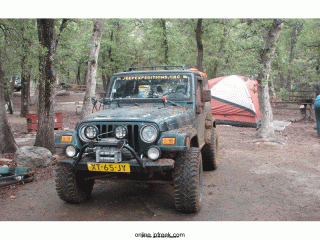
When lunch was over, we hit the trail again, heading towards the first pavement we had seen all day, some 20 or so miles ahead of us. As we came up out of a canyon, the landscape went from rocky and rough to rolling meadows. The area was beautiful with more cattle ranches along the way.
Another radio call, and Bamse’s TJ had just stopped running again. A dry tarp was laid down under the rainy skies and a couple of the guys started working on the harness again. The lift kit was not being kind to the harness or the repair but they got it running again with some TLC. More reinforcing of the harness was going to take some more engineering when he got home but it was good enough, we thought, for him to finish the trip. While this current round of repairs was being done, we sent our “scouting party” of five Jeeps ahead to meet up with Michael who was coming in from the back way to recon our planned camping spot for the night. As our plan called for us to meet him at 3pm and we were now behind schedule, we felt it important to make sure we were there at 3pm to give him our situation and to make contingency plans for the night if necessary.
We hit the trail again and we finally made it to pavement and out of the mud, at least for the time being. We joined our recon group and Michael at the Desert Museum in Rodeo, New Mexico. Michael told us that he had been up the mountain at 8600’ and the campground was a mud hole. With the current weather as it was, it could possibly ice up or snow and the group decided we needed another plan. All of the local campgrounds were full so the museum offered their grounds to us to camp for the night. Camping in a parking lot? Now that wasn’t expedition travel so we opted for another choice. We could head to the Chiricahua National Monument where we were scheduled to be on Sunday and if the campground was not full, we could stay there for the night. If there was not enough room there, part of the group could head towards Fort Bowie and camp in an area that we found on our earlier exploration trip to the area. The only thing to decide was whether to go the long way, more than 100 miles but all on pavement, or go over the mountain that is a dirt road and about 60% shorter. The mountain route would take us well above the cloud lines, which looked to be around 3500 to 4000’. We would be traveling to about 7000’.
